Regional Blue Carbon Monitoring Reporting and Verification (MRV) Mechanism
What is the blue carbon?
Blue carbon refers to the carbon captured and stored by coastal and marine ecosystems such as mangroves, seagrass meadows, and salt marshes. These ecosystems absorb large amounts of CO₂ from the atmosphere and lock it away for centuries, making them a vital natural solution for mitigating climate change.
Beyond carbon storage, they protect shorelines, support biodiversity, and strengthen local economies. Conserving and restoring blue carbon ecosystems is essential for ensuring a more sustainable future for coastal communities and the planet.
Mangroves are highly productive, carbon-rich ecosystems, storing an average of 937 tC ha⁻¹ and sequestering 6 to 8 Mg CO₂e/ha annually, which is two to four times higher than mature tropical forests.
Coastal blue carbon ecosystems can store up to 10 times more carbon per hectare than land-based ecosystems.


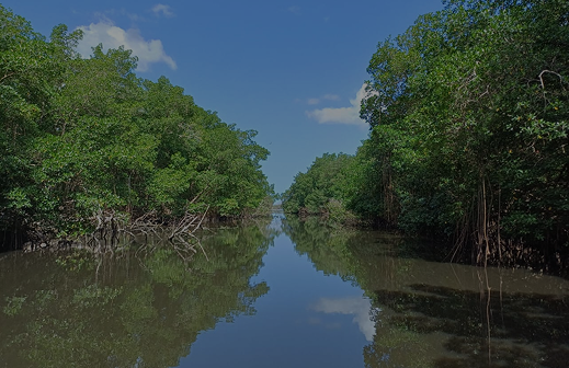
Take a look Latin America's Blue Carbon Landscape
A regional view of field data and ecosystem monitoring across key countries under the Regional MRV Mechanism program to not give the idea that it is the totality of data and monitoring across the countries.
About the project
The St. Augustine Centre for Innovation and Entrepreneurship (STACIE) at the University of the West Indies (UWI) was the executing agency of the Regional Blue Carbon Monitoring, Reporting and Verification (MRV) Mechanism project funded through the UK Department for Environment, Food and Rural Affairs (DEFRA) Blue Carbon Fund within the Inter-American Development Bank (IDB).
The purpose of this Technical Cooperation (TC) was to implement a monitoring, reporting, and verification (MRV) system for mangrove ecosystems that provided a science-based data platform on the sequestration and release of blue carbon in participant country sites of the United Kingdom Blue Carbon Fund of the IDB.
In 2019, the IDB, with support from the Department for Environment, Food and Rural Affairs (DEFRA), established the "UK Blue Carbon Fund" (the Fund) to finance projects that will help reduce climate change's negative impacts increasing carbon sequestration.
The project officially started in December 2022 and was completed in March 2026. The regional MRV was used to help monitor the progress of the projects that were implemented under the Fund. With this MRV system, the blue carbon projects of the Fund were able to:
Key outcomes of the MRV System
Improve the valuation of ecosystem services provided by mangrove ecosystems.
Potentially include blue carbon data in the (NDC), (REDD+) schemes, (SDG) programs, UNFCCC National Communications and carbon markets programs.
Utilize an innovative MRV system that could be used for results-based payments, under a reforestation program.
Opportunities for integration into country specific policies
Nationally Determined Contributions (NDC)
Stronger adaptation and resilience focus with blue carbon ecosystems.
Sustainable Development Goals (SDGs)
Integration into national plans and tracking indicators.
UNFCCC National Communications and Carbon Markets
Scaling voluntary carbon markets.
Reduced Emissions from Deforestation and Forest Degradation (REDD+)
Forest conservation + carbon finance.
Nationally Determined Contributions (NDC), Reduced Emissions from Deforestation and Forest Degradation (REDD+) schemes, Sustainable Development Goals (SDG) programs, UNFCCC National Communications and carbon markets programs
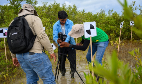
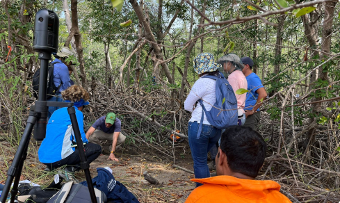
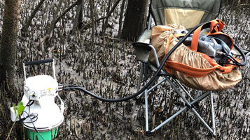
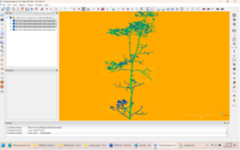
There is a growing trend to support or encourage results-based actions for reforestation, conservation, or reduced deforestation efforts. To effectively participate in or take advantage of these types of efforts, a key element of the results-based payment scheme will be a fully functional MRV. A key element of the MRV system is the use of a terrestrial laser scanner (TLS) for estimating the above ground biomass of mangrove trees.
Terrestrial Laser Scanning (TLS)
A central technical advancement of the Regional Blue Carbon Monitoring, Reporting, and Verification (MRV) Mechanism was the application of Terrestrial Laser Scanning (TLS) to coastal ecosystems.
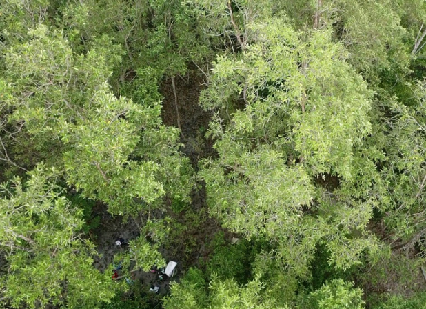
TLS is a ground-based measurement approach that uses laser scanning to generate highly detailed, three-dimensional representations of vegetation structure. In mangrove environments where dense canopies and complex root systems make traditional measurement methods difficult, TLS has provided a step change in accuracy and reduces destruction of mangroves.
By capturing precise structural data at the plot level, TLS improves the estimation of above-ground biomass and, by extension, carbon stocks. This directly strengthened the reliability of MRV systems, increasing confidence in reported values.
Importantly, this was not only a technical deployment but a capacity-building effort. In April 2025, participants from across the region completed specialised TLS training, with certificates issued by the University of the West Indies, marking an early step in embedding these methods within national and regional workflows.
As blue carbon moves further into policy and finance frameworks, the credibility of underlying data becomes critical. The integration of TLS into MRV workflows represents a significant step toward more robust, transparent, and scalable carbon accounting in coastal ecosystems.
In this context, TLS was a foundation for advancing how blue carbon is measured, understood, and valued in line with world trends.
Choose one of these nations and discover how they contribute practical scientific data to assess blue carbon stocks in their coastal ecosystems.
Jamaica
The Jamaica team is collecting TLS data using the BLK 360 G2 laser scanner on mainly Rhizophora. Wood cores are also being collected. A recent monitoring exercise has confirmed that the recent hurricane Mellissa has not caused significant destruction to the project site in the southern Clarendon area.
Suriname
The Suriname team is processing TLS data collected on mainly Rhizophora, using the Riegl scanner, which is more expensive but does not require setup of targets and automatically combines images. Wood cores are also being collected. This is a grand collaboration between University of Ghent, SBB and CELOS which has achieved great synergy. LiDAR mapping is also being conducted in the BigiPan area.
Colombia
The Colombia team team is collecting and processing TLS data using the BLK 360 G2 laser scanner on mainly Rhizophora in Caimanera. Wood cores are also being collected. The team at INVEMAR are also conducting a carbon stock analysis on the wood cores.
Panama
The Panama team was the first to be trained in the TLS methodology using the BLK 360 G2 laser scanner. This scanner uses targets to combine images. Over sixty sets of point clouds collected in Panama Bay and Parita Bay on mainly Rhizophora are being cleaned. Wood cores are also being collected. Methane measurement knowledge transfer to the other beneficiary countries is also in progress. LiDAR mapping is also being conducted in the Panama Bay area.
29 Apr 2026
Sustainability roadmap TLS and mapping
This report presents the sustainability roadmap for the Regional Blue Carbon Monitoring, Reporting and Verification (MRV) Mechanism in Trinidad and participating countries.
02 Apr 2026
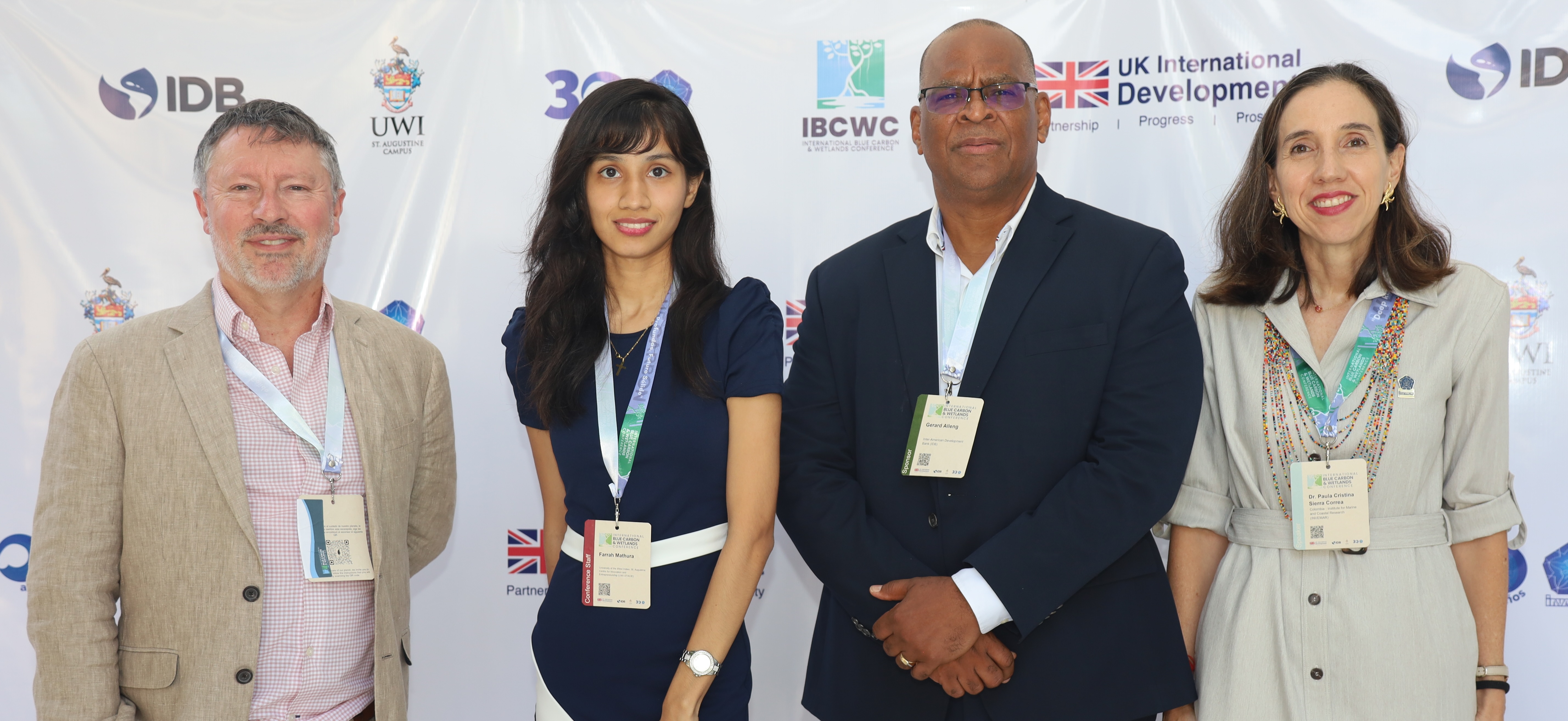
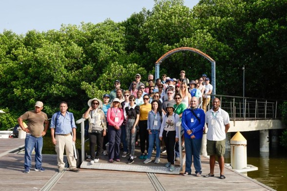
International Blue Carbon & Wetlands Conference
This video presents a summary of the International Blue Carbon & Wetlands Conference (IBCWC 2026), held February 2–3, 2026, in Port of Spain, Trinidad and Tobago, under the umbrella of the Regional Blue Carbon Monitoring, Reporting and Verification Initiative.
16 Mar 2026
Sustainability roadmap GHG measurements
Mangroves are among the world's most efficient natural carbon sinks, storing between 5.2 and 8.6 gigatons of carbon (GtC).
25 Feb 2026
LiDAR Training Manual ES
LiDAR (detección y medición por luz) es una tecnología de teledetección activa que se utiliza para medir la estructura tridimensional de la superficie terrestre y los objetos que se encuentran en ella.
25 Feb 2026
3DMTrees 3-Dimensional Mangrove Trees
The objective of this manual is to describe in detail the methods for field measurement of mangrove trees using a terrestrial laser scanner, specifically the Leica BLK360.
25 Feb 2026
LiDAR Training Manual EN
LiDAR (Light Detection and Ranging) is an active remote sensing technology used to measure the three dimensional structure of the Earth’s surface and objects on it.
14 Oct 2025
Terrestrial Laser Scanning for the Estimation of Above Ground Biomass of Mangrove Roots by Modelling Them as Inverted Trees
Blue carbon is carbon that has been sequestered in the biomass and soils of vegetated coastal ecosystems, which include mangroves, salt marshes and seagrass beds (Jakovac et al. 2020).
21 Aug 2025
Caribbean, Latin America Build Blueprint for Blue Carbon Markets
Caribbean leaders converged earlier this month on Colombia’s Santa Marta coast to explore ways to turn mangroves and wetlands into market-ready blue carbon assets that can attract investment and generate verified carbon credits.
12 Aug 2025
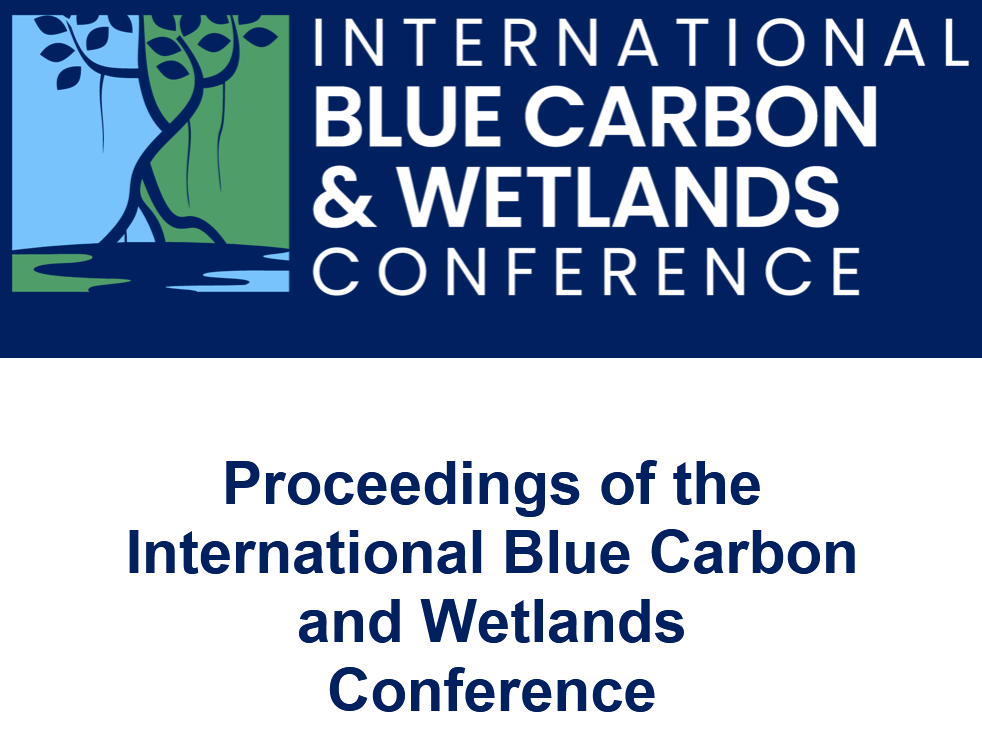
Proceedings of the International Blue Carbon and Wetlands Conference
In the face of climate change, blue carbon ecosystems play a crucial role in carbon sequestration, making them essential to global efforts in mitigating climate impacts.
Why Is Blue Carbon Important in Latin America and the Caribbean?

The region hosts some of the world's most biodiverse and highly productive mangrove systems, capable of natural-based climate change, these ecosystems serve as natural defenses against storms, flooding, and erosion, while supporting livelihoods through fisheries and tourism. Restoring and protecting blue carbon ecosystems is essential for climate resilience and sustainable development throughout Latin America.
High Carbon Sequestration Capacity
Blue carbon ecosystems in the region store carbon faster and more efficiently than many land forests.
Protection Against Climate Impacts
They act as natural barriers against storms, flooding, and coastal erosion.
Biodiversity Conservation
They support vast biodiversity, with thousands, and marine species that call these ecosystems home.
Support for Coastal Livelihoods
They enable sustainable economic activities such as fisheries, tourism, and climate-resilient community development.
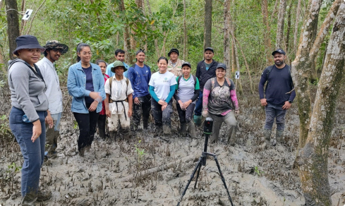
Community of Practice
The Blue Carbon Monitoring, Reporting, and Verification (MRV) Community of Practice was one of the project's most important and enduring outcomes.
Established to support ongoing collaboration across the region, the Community of Practice brought together a growing network of practitioners, currently including more than 40 members from across the UK DEFRA–IDB Blue Carbon portfolio, working at the intersection of coastal ecosystems, carbon accounting, and climate finance.
It served as a shared space for exchanging knowledge and practical experience, aligning approaches to MRV, and strengthening regional capacity to design and implement blue carbon initiatives.
In a field where methods, data, and policy frameworks are still evolving, the Community of Practice provided continuity—linking individual projects into a broader system of learning and coordination.
More than a network, it is a mechanism for ensuring that the advances made at the project sites in the participating countries under the Regional MRV Initiative continue to be tested, refined, and applied across Latin America and the Caribbean, and beyond.
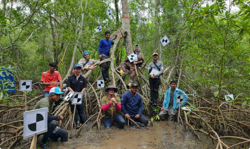
The Community of Practice was a driving force in the data collection and dissemination process and together, so much was achieved. Some of our achievements include:
- Participating in five training activities: TLS, LiDAR, allometric equations, AI modelling and methane measurement training
- Documenting of the existing protocols in the beneficiary countries
- Compiling these findings as a technical note
- Attending two workshops and two conferences enabling professional growth and development and networking opportunities
- Collecting TLS and wood core data toward country specific allometric equations
- Technical note development on these country specific allometric equations


